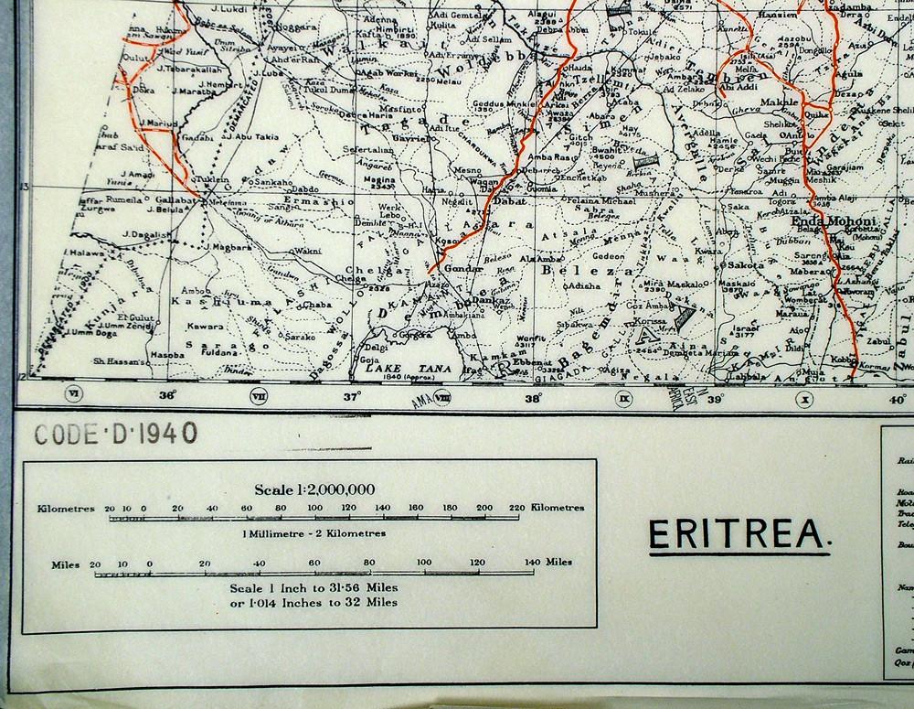
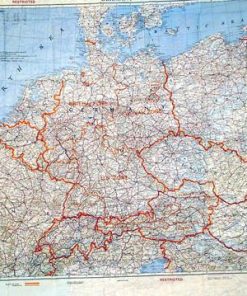
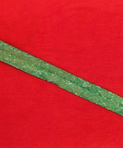
British WW2 Mulberry Leaf Tissue Map: Eritrea Original Items
$ 125,00 $ 50,00
Original Item: WW2 came expectantly upon Great Britain; years of appeasing AH had only put off the inevitable war. The disaster of the British Expeditionary Force defeated and evacuated at Dunkirk left England standing alone. Little did anyone know that by the end of 1941, more than a year away, both the USSR and the USA would have joined the war. In this interim period Britain, an island nation, made plans to combat AH and his Allies in the World Arena. This included Covert Operations and the fascinating inventions and adaptations to aid in these clandestine ventures.
A special Office of MI5 was established headed by the legendary Spy Master Christopher Layton-Hutton where “gadgets” for espionage and escape were developed. These included the “compass in heel or button” and the renowned “Silk” maps for concealment in clothing, etc; available for viewing in a permanent exhibition at Dover Castle Museum in Kent, England.
However the first covert maps were printed on tissue paper, but not just ordinary tissue paper. This special paper was made from Mulberry Leaves, which is claimed to be unaffected by water, and were eminently concealable and durable. Initially given to Secret Agents but also later smuggled to P.O.W. camps within Board Games, books and other “innocent” paraphernalia. Generally these Maps covered a large area and were of vital importance for use in Occupied Territories.
Now a very small quantity of two examples of these “Mulberry Leaf Maps” has been discovered mixed in amongst a British Government Release of obsolete paperwork. Both maps date from the earliest days of WW2 and cover areas of possible Enemy interest or occupation.
The first is of Spain, Portugal, Sardinia and parts of Algeria. Possibly among the very first tissue maps to be produced, Spain with its Fascist Government under Generalissimo Franco was considered ripe for joining AH’s Axis Powers. Fortunately this did not materialize and hence these few examples survived WW2.
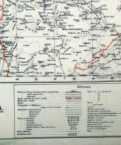
The second, actually dated 1940, is of the small country of Eritrea on the Red Sea which had been overrun by Mussolini and his Italian War Machine together with Ethiopia in Rome’s new “African Empire”. Again an area which sat on the sidelines in WW2 since the principal arena between Britain and Italy turned out to be the Libyan Dessert on the Mediterranean.
Of course both areas were continually under British Surveillance with no doubt countless covert operations being mounted in each. The fact remains that these Tissue “Mulberry Leaf” Maps are possibly the very last remaining examples of these exceptionally rare and early Covert Maps of WW2. Extremely delicate!
This is the British WW2 Mulberry Leaf Tissue Map of Eritrea ONLY.
Measurements: 18 1/2 inches by 18 1/2 inches square
| Hand Select | No, Yes |
|---|
Prompt Shipping and Professional Packaging
We provide a variety of shipping options due to our long-running partnerships with UPS, FedEx and DHL. Our warehouse personnel are well trained and will pack the goods according to our exact and precise specifications. Before shipping your items will be thoroughly inspected and secured. Every day, we deliver to thousands of customers in different countries. This is a sign of our determination to become the largest online retailer worldwide. Both Europe as well as the USA have warehouses and distribution centers.
Note that orders containing more than one item will be subject to a processing period that is based to the particular item.
Prior to shipping the items, our staff will carry out an exhaustive inspection of the products you ordered. Today, most orders will be delivered within 48 hours. The estimated delivery time is between 3-7 days.
Returns
The stock is constantly changing. It's not entirely managed by us since we are involved with multiple entities, including the factory and our storage. Therefore, the actual inventory could alter at any time. It is possible that you will not receive your order after the order has been made.
The period of time is 30 days. Unfortunately, if 30 days have passed since you purchased your product, we are unable to provide a refund or exchange.
The item must not be in use and must be in the original packaging. The item must be in the original packaging.
Related products
Uncategorized
Uncategorized
Uncategorized
Uncategorized
Uncategorized
Armored Burgonet Helmet & Polearm from Scottish Castle Leith Hall Circa 1700 Original Items
Uncategorized
Uncategorized
Uncategorized
Uncategorized
Uncategorized
Uncategorized
Uncategorized
Uncategorized
Uncategorized
Band of Brothers ORIGINAL GERMAN WWII Le. F.H. 18 10.5cm ARTILLERY PIECE Original Items
Uncategorized
Uncategorized
Uncategorized
Uncategorized
Australian WWII Owen MK1 Machine Carbine SMG Custom Fabricated Replica with Sling Original Items
Uncategorized
Uncategorized


