Original British WWII Double Sided Silk Escape Map of Occupied France & Germany Original Items
$ 395,00 $ 118,50
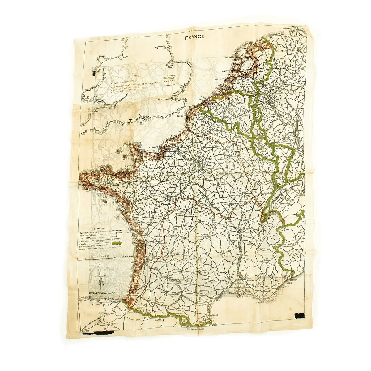
Original Item: Only One Available. This is an Original WWII British issue 18″ X 22″ Silk Escape Map, as issued to Allied flight crews in WWII. These maps were often sewn into the linings of uniforms to escape detection in the event of being shot down over enemy territory and falling into hostile hands. Most of these that we have seen only have one side, but this has TWO, one showing occupied France, including the entire northern Coast, and the Coast of Germany, showing southwards to Berlin.
Constructed of Silk to withstand water damage and tearing, the has a sewn selvage hem around all four sides to prevent fraying. In addition to cities, principal roadways and railroad lines; Canals and Rivers are also shown with arrows that indicate direction of water flow as such information was invaluable to downed pilots on the run.
The map of France is printed in Black, Green, and Red ink, and is in 1: 2,330,000 scale. It shows the coastal defense areas of France, as well as the boundary between Occupied and Vichy France.
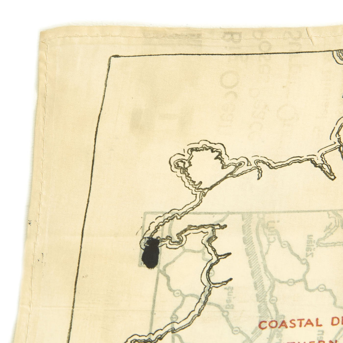
The map of the Berlin Area is a slightly smaller 1:3,000,000 scale, and is printed in black & white. The legend shows borders of 1939 and were then updated to 1941, putting these right in the thick of hostilities. It is marked Air Ministry, No.7330, and this was the best-known Escape Map issued. Sadly very few survived.
This example is in great shape, though for some reason some of the map reference numbers in the corners were blacked out, possibly for security reasons.
This is a great opportunity to have a rare map in your collection! Ready to display!
Fast Shipping with Professional Packaging
Thanks to our longstanding association with UPS FedEx DHL, and other major international carriers, we are able to provide a range of shipping options. Our warehouse staff is expertly trained and will wrap your products according to our exact and precise specifications. Prior to shipping, your goods will be thoroughly examined and securely secured. We ship to thousands clients each day across multiple countries. This shows how we're dedicated to be the largest retailer on the internet. Warehouses and distribution centres can be located throughout Europe as well as the USA.
Note: Orders with more than one item will be assigned a processing date depending on the item.
Before shipping before shipping, we'll conduct a thorough inspection of the items you have ordered. Today, the majority of orders will be delivered within 48 hours. The delivery time will be between 3-7 days.
Returns
The stock is dynamic and we cannot completely manage it because multiple stakeholders are involved, including our factory and warehouse. So the actual stock may alter at any time. It's possible that you may not receive your order once the order has been made.
Our policy is valid for a period of 30 days. If you don't receive the product within 30 days, we are not able to issue a refund or an exchange.
You can only return an item if it is unused and in the same state as the day you received it. You must have the item in its original packaging.
Related products
Uncategorized
Angolan Rebel 1970s era 60mm Inert Display Mortar from Angolan Civil War Original Items
Uncategorized
Armoured Fighting Vehicles of the World: AFVs of World War One (Hardcover Book) New Made Items
Uncategorized
Uncategorized
Uncategorized
Uncategorized
Uncategorized
Uncategorized
Uncategorized
Uncategorized
Uncategorized
Uncategorized
Uncategorized
Uncategorized
Uncategorized
Armored Burgonet Helmet & Polearm from Scottish Castle Leith Hall Circa 1700 Original Items
Uncategorized
Uncategorized
